Now I can really understand why the road up to Mount Evans is being closed with the first possible snowfall. Due to missing guardrails, the narrow, curvy and sometimes pretty damaged street seems fairly scary. After all it’s really steep on the downhill side. It’s insane! But principally: insanely beautiful!
If you have read my last post about Denver/ Colorado, you may remember that we didn’t make it up to Mount Evans. At that time (in mid-May) the road was closed due to heavy snowfalls. Last weekend I was back in Denver for a few days and therefore had another chance to get up the mountain this year. “This time I’ll definitely get up the Mountain!”, I thought to myself when I saw that the weather was forecast to be around 93° F (34° C) and after all it still was summer. Turned out I was pretty lucky. Because when I arrived in Denver, I found out that Mt Evans Road would be closed a few days later already – the last 5 miles, that is. I learned about this from articles like the one from the Denver Post. I might have guessed as the summer turns out even shorter on a summit at the elevation of 14,300 ft (4,300 m).
When the way is the goal (No, really!)
Why I wanted to get up there in the first place? Not because it’s one of the highest mountains in Colorado. Neither is it a challenge mountaineering. What makes Mount Evans so special is the 14 mile long serpentine scenic drive up to the summit. So here it’s literally: the way is the goal. Not only the drive amazing is amazing though. Mt Evans Road is actually the highest paved road in North America. When the road works were completed n 1930 after 7 years of construction time, it even was the highest road in the world. That’s so American, a lot of people would probably think now, as they tend to drive everywhere and anywhere. And yet indeed there are only 130 ft left to walk from the parking lot to the actual summit. However, there are a lot of cyclists and a few hikers hiking up from Summit Lake. So not only should you be aware of the mountain goats and bighorn sheep when you drive up the mountain, but also look out for all the cyclists.
Echo Lake
On the way from Denver to the Mount Evans Road you pass Echo Lake and this is where the journey begins. As I mentioned in my last post about Colorado, you can generally pull over anywhere to take pictures or just enjoy the view, which constantly changes from here.

Mount Evans Road
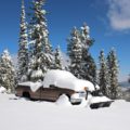
Right after the lake, you turn right to enter Mt Evans Road. Here’s what it looked like in May with lots of snow compared to this time. Didn’t it actually look a lot prettier with all the snow? Only that the road isn’t drivable at those times. Oh well!


Before getting onto the actual road, you’re asked to pay up. It’s 15 $ per car (Effective: 2017), while the ticket is valid for three days. Btw paying cash here is faster than paying by card for once.

There are always places to park here and there where you can enjoy the views. From about 11,500 ft. you’ll leave the timberline behind and the landscape becomes rocky. The streets get more bendy and the view gets even better…

Summit Lake
Driving up a little further, you’ll reach Summit Lake, a beautiful mountain lake which is situated a little beneath the summit. You could also park your car here and hike up the remaining 1430 ft. or possibly even have to until the end of June and the beginning of September when the further stretch of road is still closed or not yet open for cars. Btw, just before the lake the road conditions are pretty bad – potholes mar driving pleasure and it gets bumpy.


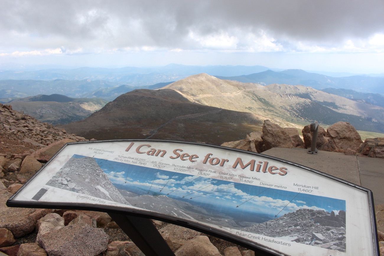
A few serpentines further you’ll finally get to the summit of Mount Evans. Besides a viewing platform, you’ll find restrooms here and the possibly highest cycle rack in the world. From here, there are only 130 ft. left to hike up to the summit. You won’t need exceptional stamina, but you may notice the rarefied air and breathing may be a little harder. When I was up here, it was extremely windy and very cold. The car also made me aware of 37° F and “possible icy roads”. Did I at least bring appropriate clothing this time? Of course not! If only I had taken a warm jacket with me… Anyway, the views were fantastic and they let me forget about the freezing wind. For a minute by all means.

There were a few beautiful white mountain goats peacefully sleeping on the rocks. White mountain goats tend to herd together and are most frequently sighted in the rocky cliffs above timberline landmarks of the Mount Evans area.


On the way down, there are a lot of opportunities here and there to stop and enjoy the view again. In the picture below, you can see Echo Lake once more – the lake at which the journey began, remember? In good weather a great view of the Rocky Mountains fourteeners presents itself.

Conclusion: If you happen to be in Colorado and have the opportunity, you really shouldn’t miss out on Mount Evans or rather the scenic drive up there – good weather assumed. The Mt Evans Road is a beautiful drive and therefore a great experience for the driver; the front- (and back-) seat passenger(s) should not be afraid of heights though.
Mount Evans at a glace
- Elevation: 14,271 ft (4,350 m)
- Mt Evans Road: 14 miles (23 km)
- Mt Evans Road – construction period: 1923-1930
- Open to the public since 1931
- Entrance fee: 15 $ / car (Effective September 2017)
The road to the top of Mount Evans is typically opened from Memorial Day till Labor Day (firs Monday in May till last Monday in September). Mt Evans Road is usually open until the first significant snowfall or the first weekend in October, which ever is first.
It’s only worth a trip if the weather is good. So be sure to choose a sunny day and drive up early in the morning since clouds and even thunderstorms may be approaching in the afternoons. A day during the week could be an advantage as there are only a few parking lots, both at the summit and at Summit Lake.
From Denver: West on US Interstate 70 to Idaho Springs (exit 240 “Mt. Evans”), then south on Colorado 103 to Echo Lake. Right after the lake take a right to Mt Evans Road (Highway 5) – this is also where you pay the entrance fee.
By car, bike or by foot. Hiking up is possible from the Summit Lake Trailhead (1400 ft or about 2.9 miles walkway to the summit).
With these things you’re basically equipped for intensive sunlight, partly strong ice cold winds and the altitude:
- water (drinking lots of water is important to not get sick of altitude.)
- sun blocker
- sun glasses
- jacket or warm clothing in general
Browsing through all of my Colorado pics, I came across beautiful photos from a sunrise over Denver, one of them you can see below. I saw this sunrise in July 2016 from the Red Rocks Amphitheater. Check out my last Colorado post for more information about the theater and what it looked like in May.

- New Year’s Day (January 01)
- Memorial Day (always the last Monday in May: May 29, 2017, May 28, 2018)
- Independence Day, also called “The Fourth of July” (July 04)
- Labor Day (always the first Monday in September: September 04, 2017, September 03, 2018)
- Thanksgiving (always the last Thursday in November: November 23, 2017, November 22, 2018)
- Christmas Day (December 25)
- Paying cash, exact amounts (incl. tip!): leave on the table and leave.
- Paying cash, expecting change: wait until waiter takes money on the table/ in the money folder and brings change. Leave an appropriate amount of tip on the table and leave.
- Paying by credit card: place card in money folder/ with check and have it collected by the waiter who comes with another check you have to sign. Then you could either write down the amount of tip (and the total amount) or leave the tip on the table in cash.


